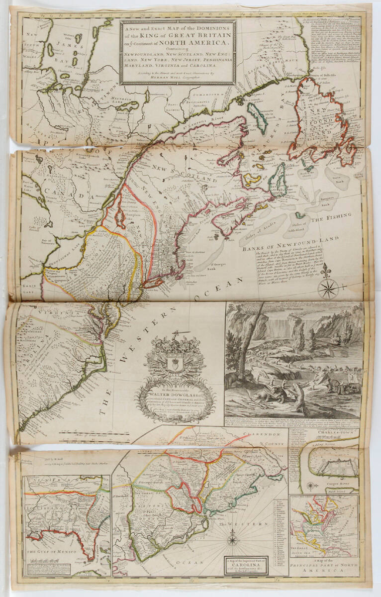
Map of North American Colonies
Artist
Herman Moll
(American)
Date1715
MediumMap
DimensionsOverall: 40 3/4 × 24 7/8 inches (103.51 × 63.18 cm)
Credit LineDonated by Frank Glenn for the 6th War Bond Auction; purchased and given by United States Cold Storage Co.
Object number44-51/8
On View
Not on viewCollections
DescriptionMap showing Newfoundland, New Scotland, New England, New York, New Jersey, Pennsylvania, Maryland, Virginia, and Carolina. Engraving of beavers making dam at Niagara.
Information about a particular artwork or image, including provenance information,
is based upon historic information and may not be currently accurate or complete.
Research on artwork and images is an ongoing process, and the information about a
particular artwork or image may not reflect the most current information available to the Museum.
If you notice a mistake or have additional information about a particular artwork or image,
please e-mail provenance@nelson-atkins.org.

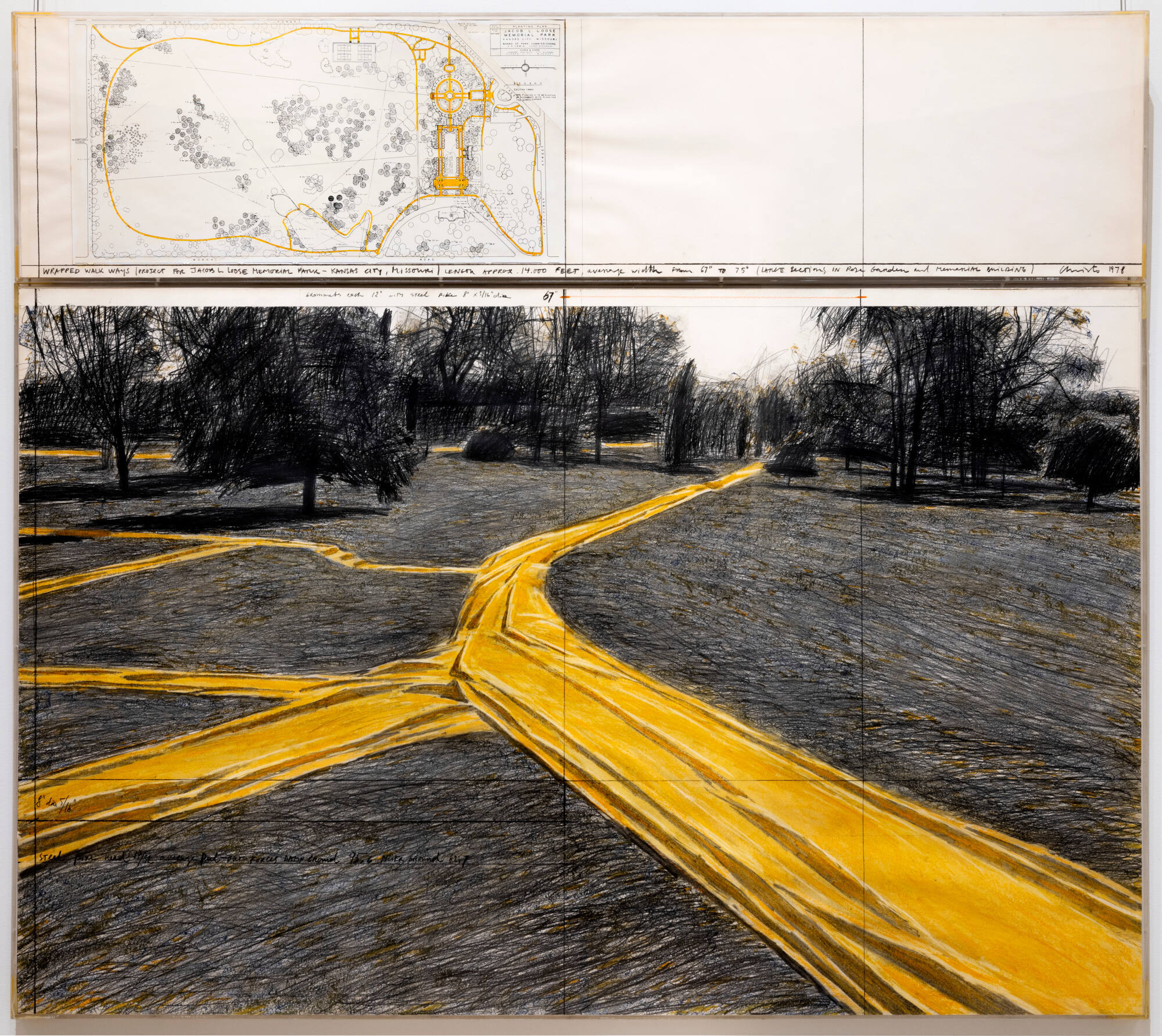
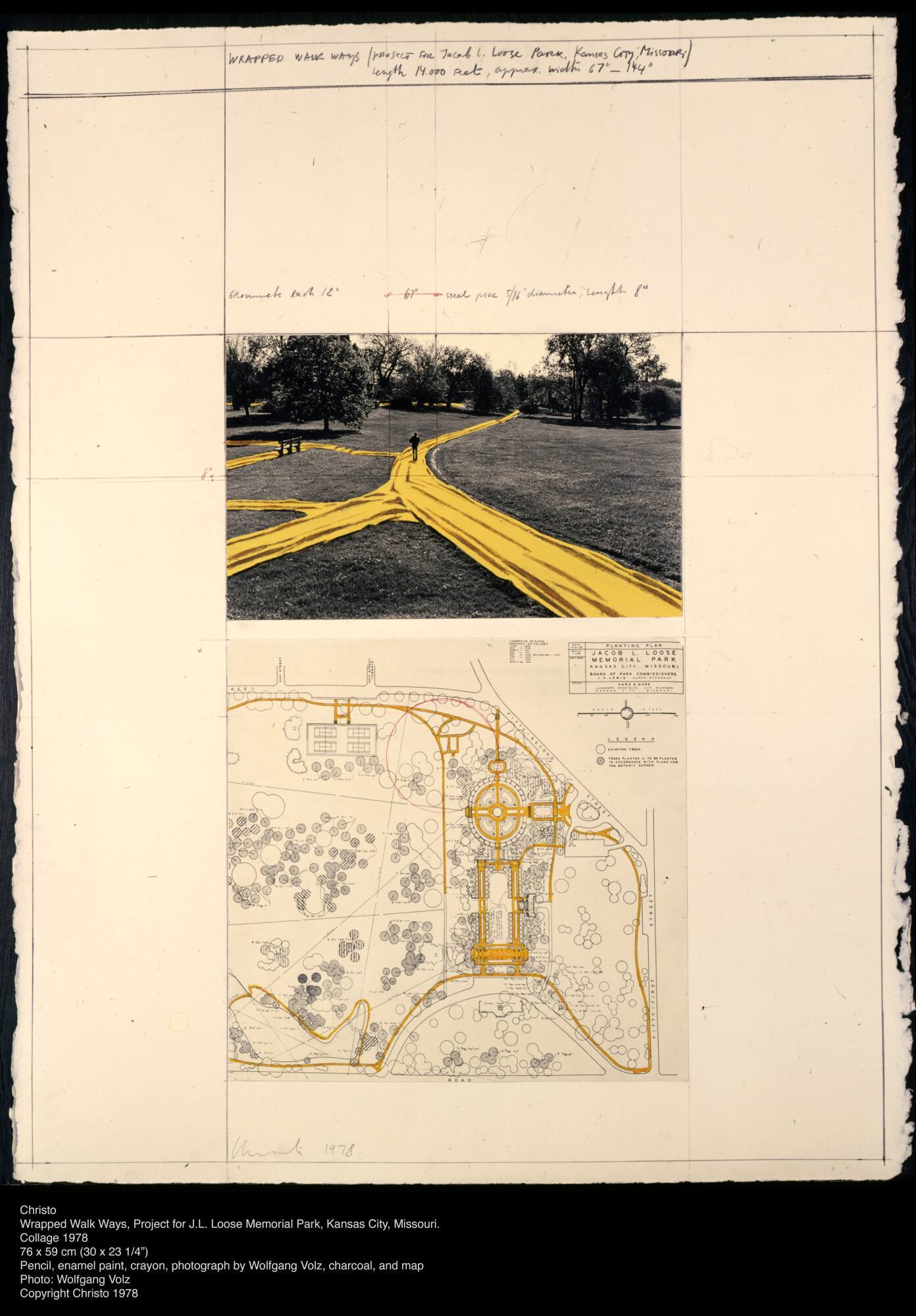
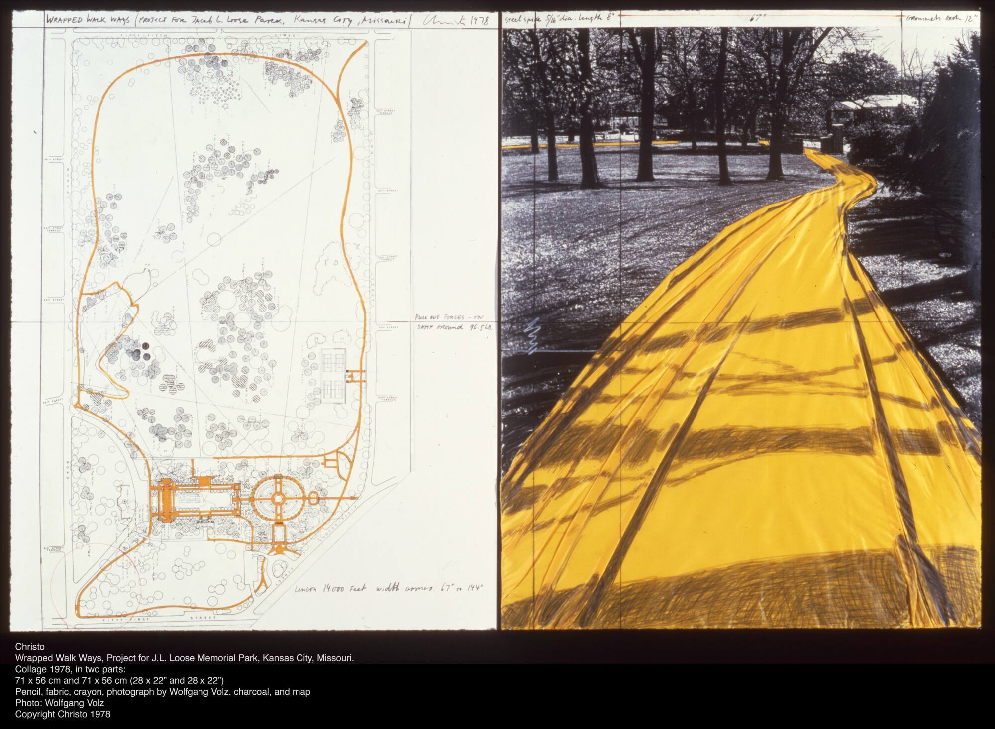
Christo
1978
2024.68.3.1,2
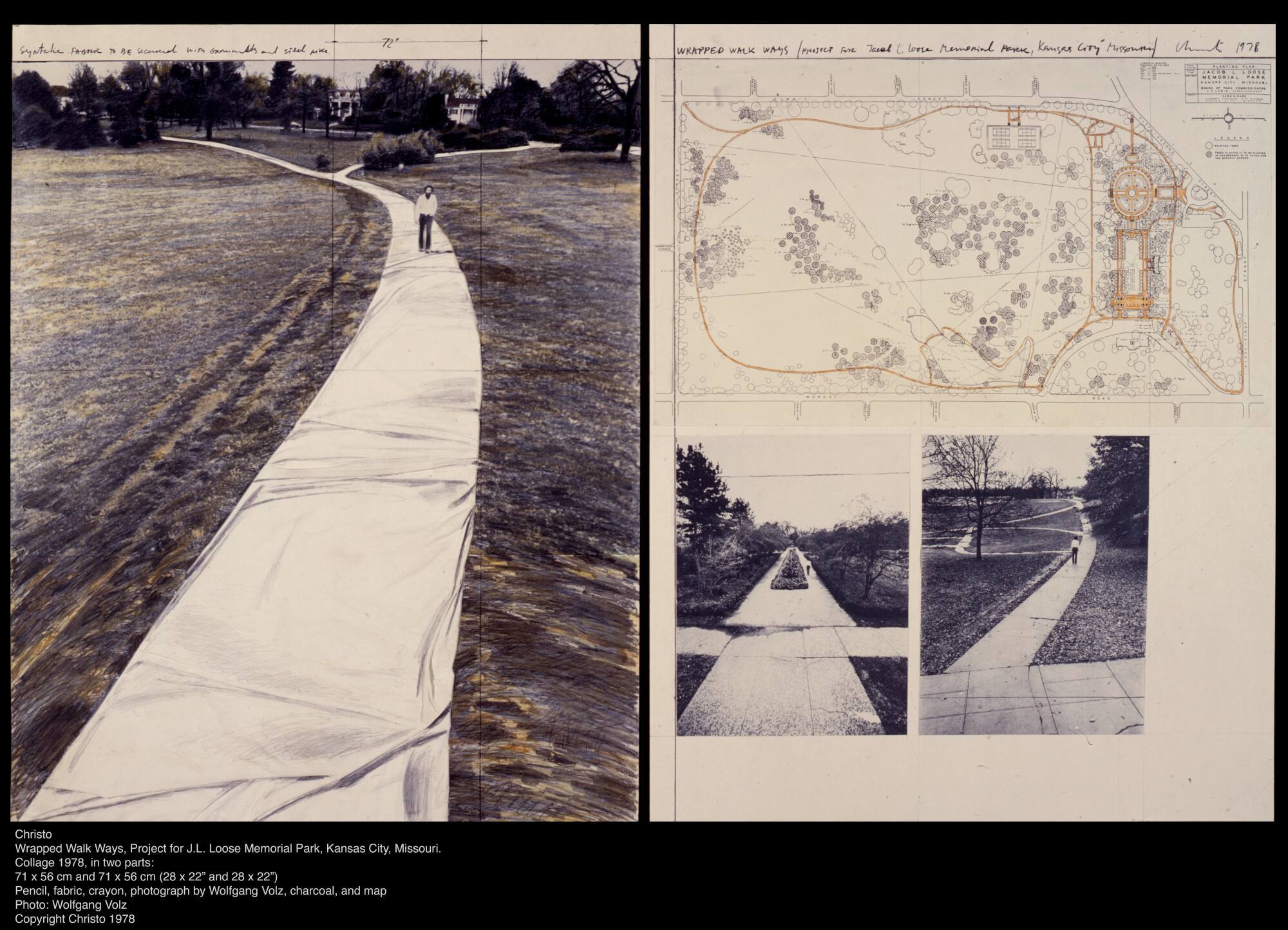
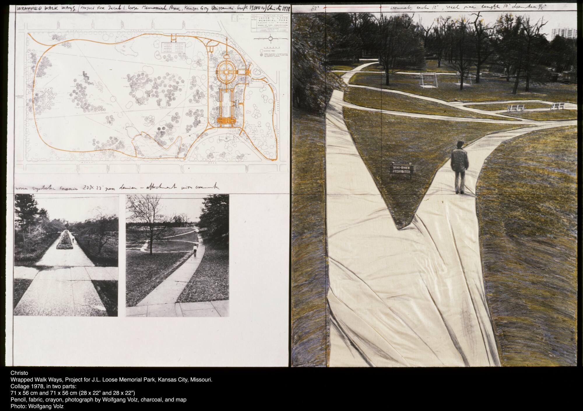
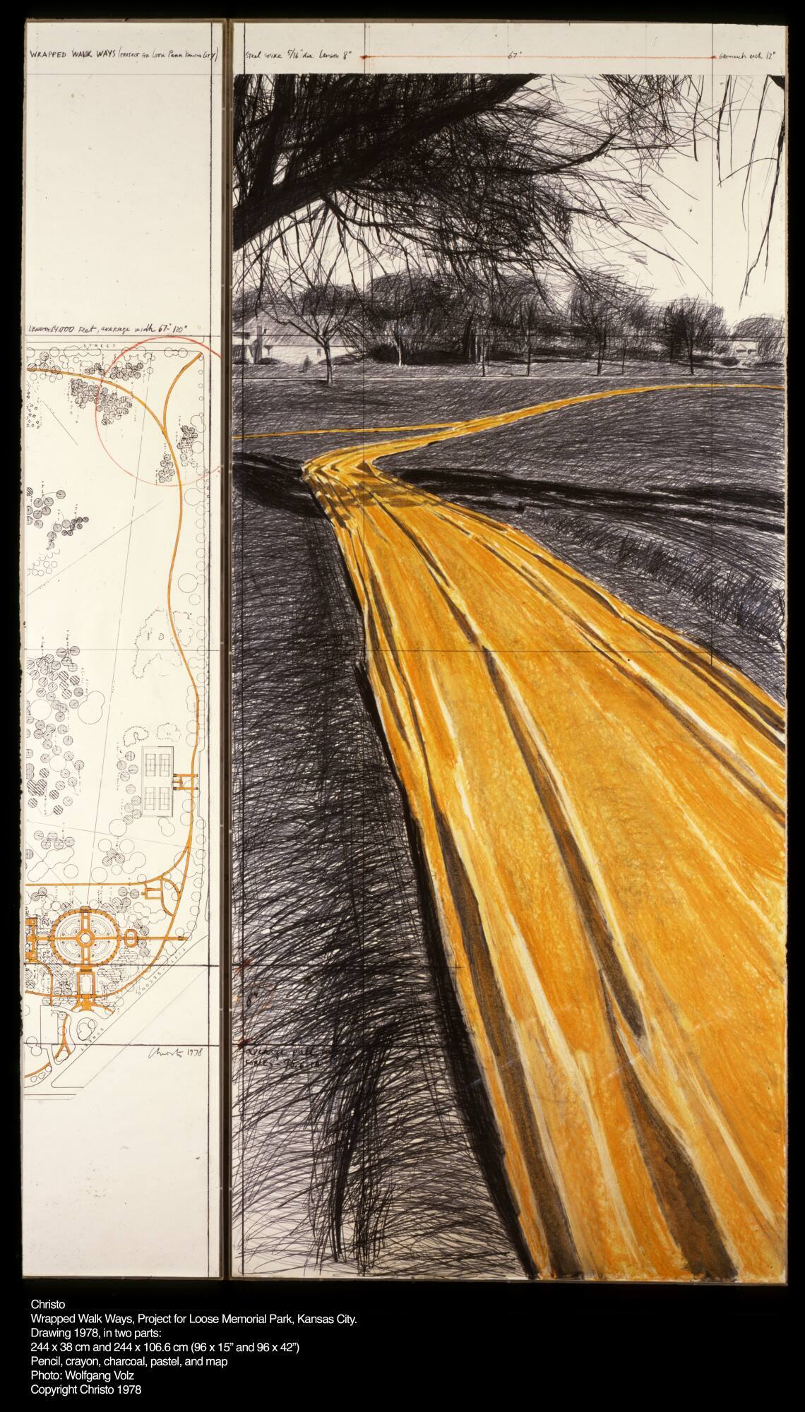
Christo
1978
2024.68.14.1,2
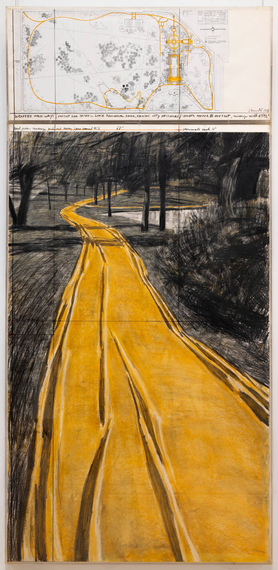
Christo
1978
2024.68.16
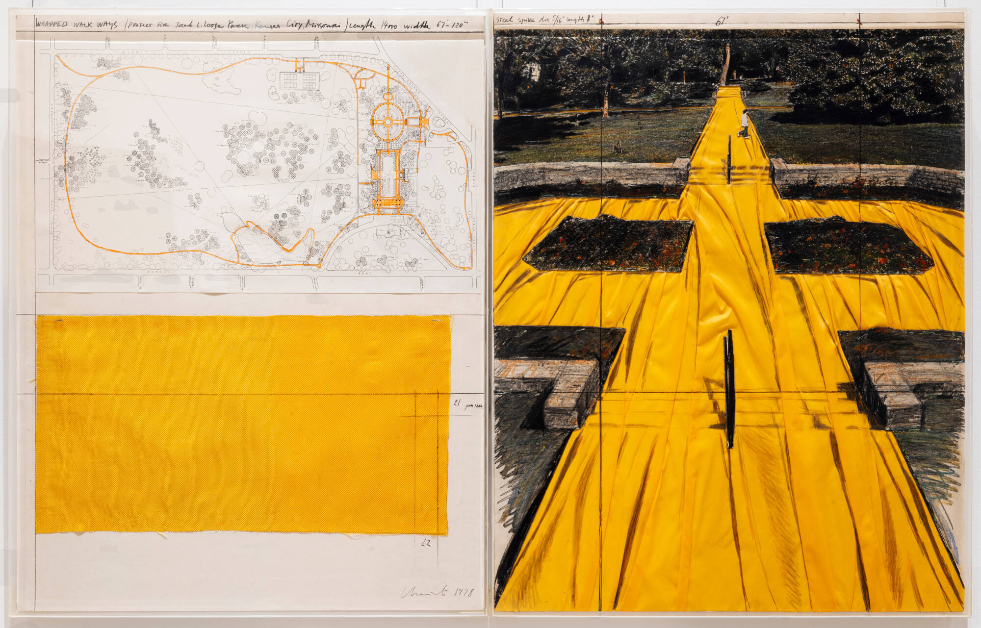
Christo
1978
2024.68.13.1,2
Christo
1978
2024.68.1.1,2
Christo
1978
2024.68.12.1,2
Christo
1978
2024.68.15.1,2
Christo
1978
2024.68.17.1,2

Thomas Joshua Cooper
1998-2001
2005.27.4974